For those with a particular interest in my 3D Rendering, this gallery provides a dedicated look at my work.

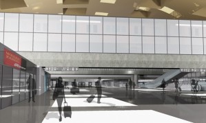
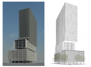
The Grand Central Hotel + Condo in Chicago was a project undertaken by a group including myself as part of a final demonstration of topics mastered during a class concerning real estate finance fundamentals. The challenge involved developing a mixed use retail/hotel/condominium project in the South Loop of Chicago just south of the Congress Parkway and east of the South Branch of the Chicago River. My contribution focused on the financial and space allotment aspects of the project, determining the precise size of hotel and condo units as well as the unit mix in both components in order to provide a conservative yet appealing financial return for investors. This involved extensive zoning research to determine how to maximize building space and revenue while remaining within municipal provisions.
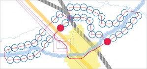
The city of Aubretia will be a city for approximately one million people situated at the northern divergence point of the proposed California High-Speed Rail Authority system and the current San Joaquin Amtrak passenger rail service, located near Madera city. Having the largest population out of all 50 states and three cities—Los Angeles, San Diego and San Jose—in the top ten list of most populous US cities, California certainly has the demand to support a high-speed rail system. The 2010 United States Census has also demonstrated a continuing trend of residents relocating from the Midwest and East Coast to the Sun belt states.
All inhabitants of Aubretia will have access to a heavy two-rail system providing transportation to any other point in the city in 45 minutes or less. Development will be restricted to an area approximately one half mile in radius or a ten minute walking distance centered on each transit stop. Along with standard rapid transit stops in each development area there is also an interface with a central transportation hub connecting the Aubretia Metro to Amtrak and California High-Speed Rail as well as ground transportation options like municpal bus and for-hire vehicles.
The planned population level for Aubretia is based on a city size that can be served with a two-track automated metro system. The system will be capable of accommodating a majority of rush hour commuters at three persons per square meter density with a minimum headway of 90 seconds.
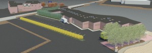
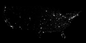
AutoLISP is a powerful tool for expediting repetitive tasks in AutoCAD. Seeking to find real world data to use in architecture, I hit upon the idea of using census data to create forms. While I did not end up pursuing this as a design tool I did develop several programs to graphically interpret census data. One of the first programs I devised was a simple geolocation program to create circles at coordinates.