The Bus Crush

The #6 Sycamore bus travels between Waterfront Village south of Downtown Buffalo and Walden Galleria in suburban Cheektowaga. Walden Galleria is an important economic engine for the Niagara region, attracting thousands of Canadian shoppers to the Buffalo area every week. The #6 Sycamore bus is a vital link between Buffalo and Walden for shoppers and employees, being one of only two bus routes (alongside the #32 Amherst) that provides a one seat ride to this major commercial center. Unfortunately this level of service has become increasingly dismal in my opinion.

The end of the summer season provided some relief from crowds on the NFTA buses, especially during weekends. Now that winter is almost in full swing the crowding situation on the #6 bus has returned, reaching a point where for the first time in four months I was left behind at a stop because there was no more space. The Sycamore bus only runs every 30 minutes during non-peak hours, a woefully low level of service considering that it serves one of the largest retail employment centers in the entire metropolitan area, and employees there are more likely to use public transportation to get to work especially considering the demographics along the route. The fact that the bus that left me behind was the bus before the bus that I would need to catch without being late to work only added to the insult, making my prudence moot.

The Sycamore bus is frequently crowded outside of the traditional weekday rush hour period. The bus runs that I frequently use are between noon and one PM, and the buses are frequently standing room only as they leave downtown. Weekend buses are worse as the headways can grow to over one hour. A recent Saturday trip saw standing room only and frequent delays during the boarding of passengers. Even worse, the crowding situation was only relieved well into the run when the bus had already completed around 75% of the route between Walden and Downtown Buffalo. In the end the bus run almost 12 minutes behind schedule by the time it reached downtown Buffalo, which is over 30% of the estimated run time.

Tap Card

Tap the Card for a Trip

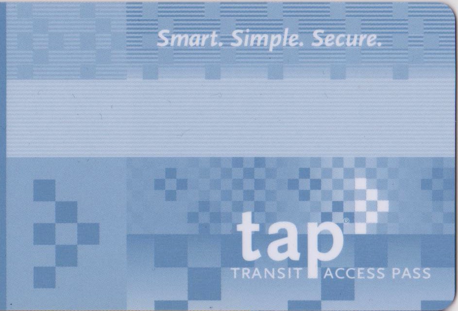
Upon arrival in Los Angeles for the first time in over four years I was admittedly surprised to learn that the paper tickets for proof of payment on Los Angeles Metrorail had been completely phased out only a few weeks earlier. In their place was a new smart card system called TAP (Transit Access Pass), whose validation posts I had seen pop up over time while residing there. After some initial confusion it was quite pleasant to discover that not only did the fare vending machines dispense TAP cards for a small fee, they also allowed riders to load a variety of passes on their cards. After considering the smart card systems I had used in Chicago (Chicago Card) and Washington DC (Smartrip) I felt compelled to compare the advantages and disadvantages of these particular cards used by the transit systems as they pertain to me.

Los Angeles: TAP card

Tap Card

The Transit Access Pass or TAP Card, aptly named, is used primarily by Los Angeles Metro on their rail and bus services. One reason for introducing a smart fare card system was the need for passengers to pay in order to pass through a turnstile. Los Angeles Metro had for a long time operated using a proof-of-payment system where riders had to display their ticket upon request by a fare inspector. The entire system was barrier-free for a long time which made sense considering the at-grade layout of the first light rail line in LA, the Blue Line running from Downtown LA to Long Beach. Fare gates would present no obstacle to evaders at these stations. When the Red Line subway and Green Line light rail systems were completed proof of payment was used on those systems as well, even though there would have been no obstacle to implementing fare gates at those stations (Red Line positioned underground and Green Line elevated and/or freeway median). The entire system remained barrier-free and the opportunity to implement fare control was passed over. While magnetic strip paper fare card systems had been in use for a while on systems like the Washington Metro the system designers in LA apparently decided to forego this step and simply wait for smart card systems. An interesting comparison comes up when comparing the Los Angeles Metro to the Buffalo Metro. The Buffalo Metro uses paper fare cards with a magnetic strip even though the system is strictly proof-of-payment (although it wouldn’t be difficult to implement fare gates in the subway portion, the cost-benefit analysis has clearly yielded a nay on the issue). The magnetic strips are used when paying bus fare, and the printed nature of the ticket means that it can be verified visually if there is a technical issue. The tickets have a reflective dazzle pattern to deter counterfeiting, a feature the Los Angeles Metro tickets never had, which perhaps contributed to fraud and revenue loss in addition to fare evasion.

Pros:

  • Fare Options: Pretty much any type of pass or fare can be loaded onto the TAP Card at a Ticket Vending Machine, which support cash as well as debit and credit cards. This includes daily, weekly and monthly passes as well as zone surcharges.
  • Dual fare option: Passes and cash can be loaded on the card at the same time, which simplifies fare payment significantly. If a rider’s pass is not valid on a particular transit system, then the cash fare can be deducted instead. The TAP Card is an interagency card but the agencies retain their own fare systems although there are transfer privileges. Still, the ability to hold passes and cash means that a rider only needs one card for their entire journey. There is also a nice benefit for the forgetful transit rider, in that as long as they have sufficient cash on their card they can still ride in the event they have forgotten to renew an expired pass. Such an option would certainly alleviate frustration among some riders.
  • Acquisition: a TAP card is comparatively easy to obtain compared to other systems where applications have to be submitted and cards mailed since they are dispensed at ticket vending machines, and sold on buses as a daily pass; considering that it is the only fare payment option for the steadily expanding rail system, this is a no-brainer.
  • Replenishment options: putting more money on the card can be done at a TVM, online, over the phone, or at retail outlets. Considering how vast Los Angeles County is, the more options the better. One common criticism of the Smartrip card in DC during its early days was how hard it was to get ahold of one and put money on it.

Cons:

  • Online fare options: Only straight replenishment or a monthly pass is available online. All the other pass options have to be purchased before riding the system. The dual cash-pass nature of the card may have something to do with this; unless the fare system has the capability of allowing riders to select when they want their daily or weekly passes to be used, there would be no way for the fare payment machines to know what option to select when the rider taps their card to the machine. Monthly passes are less of an issue since they are intended for frequent riders and likely to be used with high frequency. The lack of options online contrasts with TVMs that allow riders to add daily and weekly passes to their TAP cards. Perhaps there is a financial reason why Metro will not allow lower value passes to be added online (maybe related to transaction fees) or there is a limit to how much information the cards can contain so there would be no point in selling multiple day passes for different dates in advance. In cities like Buffalo that offer day passes they are only valid on the day they are purchased, mainly because the passes sold at TVMs are still proof-of-payment with printed dates even though they feature a magnetic strip, which could encode the necessary date information. On the other hand most of the passes sold are plain paper with dates and serial numbers, so selling day passes in advance would raise costs and likely lead to waste.
  • No fallback in some cases: if a TAP card malfunctions on the bus, fare can still be paid with cash. The train, on the other hand, is TAP only (and the only way to pass through turnstiles on the subway). Even though riders are supposed to tap their TAP cards to pay their fare before boarding, something could still happen to them later. When riding MARTA in Atlanta after the implementation of the new Breeze system my first trip resulted in a declined smart fare card when transferring from train to bus; the operator simply let me board, and I sensed this was a regular occurrence in those days.
  • Need for validation: since the bulk of the Los Angeles Metro rail system is barrier free there are undoubtably quite a few people who simply neglect to deduct their fare by tapping their TAP cards to the fare machine before boarding and face fines as a result. Even if someone has sufficient money on their card for their trip, Los Angeles Metro is quite explicit on the need to TAP before each boarding. Other systems require more steps: the PRESTO fare card in Toronto requires riders using the GO Transit commuter rail to tap their cards before and after riding in order to calculate the appropriate fare unless the rider has selected a preferred route. Failure to tap off results in underpayment and problems for the rider.

Pedestrians II: Crosswalk vs car

Part 2 of a new series about pedestrian interactions. Commuting to work by bicycle for the first time in over a year has reminded me about the practice of allowing right turns on red. A measure intended to improve fuel economy by reducing idling at intersections, its effect on pedestrians and the general attitude on the road is less than stellar. Drivers waiting to turn right in Chicago frequently honk their horns at cars in front of them that are yielding to pedestrians. The risk to pedestrians does not appear to be great, as federal sources reported only 84 fatal crashes during one ten year period [1]. While figures like this seem to indicate that the benefits of right turn on red outweigh the costs, the attitude shown towards crosswalks is still a negative than needs to be addressed in many cities.

Roosevelt and Columbus

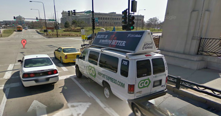
The stop line is a fairly obvious marking in the road before the crosswalk where cars must come to a halt at an intersection. I have seen cars frequently stop in the crosswalk, especially in the Lake Shore Drive/Columbus Drive downtown area. The right turn lane for Roosevelt Road eastbound at Columbus Drive seems to be a magnet for this kind of behavior. A situation frequently occurs where two cars have the standard crosswalk area obstructed, forcing people to walk between cars while inside the crosswalk. One tiny error and someone could be hit and pinned between two cars. In some cases this behavior seems to occur because the stop line is set far back from the corner of the intersection for various reasons.

There is also the issue of yielding to pedestrians and the car honking that occurs when people waiting to turn right grow frustrated with the waiting. New York City has a $350 finefor unnecessary honking (honking is only to be used for emergencies, not as a substitute for shouting). Why Chicago has not considered a similar ordinance is quite puzzling. New York City has a reputation for bluntness yet there is also a strong desire for civility judging from the honking ordinance.

Roosevelt Underpasses

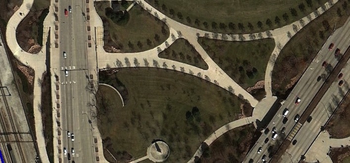
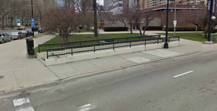
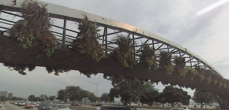
A lot of these issues could be avoided by eliminating the downtown crosswalk issue altogether through the creation of pedestrian underpasses along Lake Shore Drive. LSD and Columbus Drive have pedestrian underpasses just north of Roosevelt Road, while all other crossings involve pedestrians traversing ten lanes of traffic. In some cities like Las Vegas traffic engineers decided to build bridges for pedestrians. The crossing method of choice in Chicago varies between bridge and tunnel; some pedestrian only crossings like North Avenue Beach-North Side and 35th Street use bridges while Chicago Avenue and North Avenue use tunnels.

Chicago Ave Underpass

North Ave Bridge

Pedestrian underpasses would be less obtrusive, but they have obvious safety issues especially at night. Another issue is what happens to the gardens at the corners of Grant Park, since the tunnels would need ramps in addition to stairs. Ramps provide accessible access to the pedestrian tunnel as well as speed up pedestrian flow compared to stairs. The approach to the tunnel would either consume the existing sidewalk forcing it into the park or be situated in the park itself.

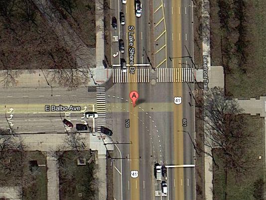
Balbo and Lake Shore Drive

The solution would be to locate the approaches outside of the park to the north and south. This would avoid having to demolish a part of the distinctively corner gardens. Another solution which would avoid this whole issue would be to eliminate the crosswalks at either end of Grant Park and instead construct a large tunnel running straight between Buckingham Fountain in the center of the block bounded by Balbo and Jackson. This would certainly be more efficient and provide a tunnel that could handle large crowds better compared to multiple small tunnels.

Check back for proposals for these tunnels…

Pedestrians I: Cycling around the pedestrian problem

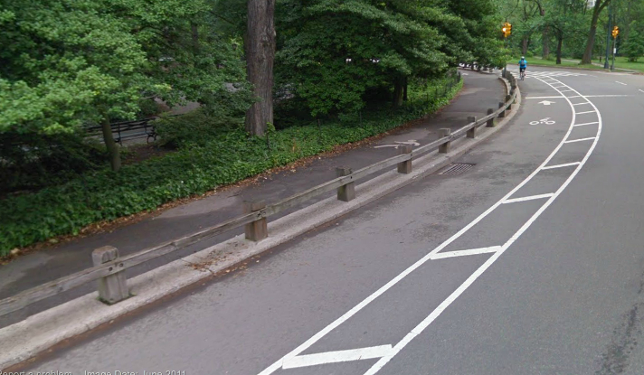
A recent visit to New York resulted in my attention being drawn to the differences between Chicago and New York when it comes to the design of outdoor recreation paths. The Chicago Lakefront Path is a simple bi-directional path where pedestrians and cyclists intermingle in a less than harmonious fashion on occasion. This is a stark contrast to New York City where the recreational paths have the right-of-way for various users delineated with clear markings and signage. In general, paths are arranged from left to right in the following order: pedestrians, cyclists, and vehicles. In places like Central Park and Prospect Park, as shown in the above image, paths are explicitly one way. This system practically eliminates the possibility of head-on collisions between cyclists since there is no passing traffic in the opposite direction to worry about; cyclists only have to ensure that there is enough room for them to pass without intruding into the pedestrian lane. The path in Prospect Park even has a buffer area marked off to train people to keep a distance from the bike lane.

Brooklyn Bridge Pedestrian Path

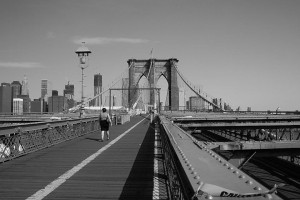
Narrow paths like the one on the Brooklyn Bridge have the left hand side (facing north) reserved for pedestrians and the right hand side reserved for cyclists. The condensed and expanded systems both have one thing in common: traffic is separated from left to right according to speed. The slowest traffic, pedestrians and joggers, travel on the left side while the fastest vehicles travel on the right. Another advantage of situating the vehicle lane on the right hand side of the recreation path is that it is always on the “outside” edge when it comes to the park. This means that vehicles leaving or entering the park do not have to cross pedestrian and cyclist traffic lanes in most cases.

Chicago cannot use the unidirectional system for obvious reasons on the Lakefront Path. The pedestrian-left/cyclist-right system used on the Brooklyn Bridge could be implemented, however. This would significantly reduce the problem of fast moving cyclists having to pass slower pedestrians. Unfortunately, lane markings alone are not sufficient to ensure proper adherence to the rules of the path. Pedestrians routinely walk in the wrong direction on recreational paths, and gaggles of people can completely block the flow of traffic at times.

Central Park Path

One solution to pedestrian interference with cyclists would be to physically separate the pedestrian and cycling lanes. Some sections of the Central Park recreation road have a short fence between the pedestrian path and the cycling lane to further discourage interaction between the two groups. This does not prevent joggers from using the cycling lane, though. Only repeated reminders of etiquette through the use of signage and outreach by various interest groups will help keep different groups separated and reduce the opportunity for accidents.

This does bring up the issue of responsibility for avoiding collisions in a shared traffic lane. Even if there are separate lanes for pedestrians and cyclists such a system in itself cannot ensure proper separation, unless there are actual civil penalties for improper lane usage. Cars cannot go the wrong way down a one way street for instance; such an action is a violation of the rules of the road and carries a penalty. Unless a similar system for recreation paths is implemented the signage and lane markings are purely advisory. A cyclists who hits a pedestrian in the cycling lane, even if they are at fault, could conceivably argue that that the collision would not have occurred if the pedestrian had observed the lane markings and stayed in their lane.

This issue of cyclist-pedestrian interaction is perhaps not as visible compared to vehicle-pedestrian interaction which involves numerous deaths every year. It still deserves more study, especially with the increasing amount of cycling traffic in this day and age combined with vigorous lobbying by health groups for more exercise in industrialized societies. I look forward to tackling the cyclist-pedestrian issue in the future.

CTA South Side

CTA South Side thoughts

Chicago Redeye: South Side Proposals

The CTA’s recent announcement of various proposals for enhancing service along the South Lakefront Corridor is frustrating to say the least. Some of the proposals involve restoring service that was cut at various points in the past, like Green Line service beyond East 63rd/Cottage Grove and express bus service on King Drive. The King Drive proposal is notorious because it paints the agency as having bipolar tendencies that would go a long way toward alienating passengers. Riders will not take kindly to services disappearing and reappearing every few years. Unfortunately, the CTA is under the mistaken impression that they are the stars of another live-action adaptation of Brigadoon and they’re apparently okay with that.

Enhanced Bus Service: The CTA has proposed a new crosstown bus route on 83rd Street, in between existing bus routes on 79th Street and 87th Street. At first glance this appears to be a reasonable move considering the two aforementioned routes were ranked 15th and 1st for weekday traffic between 2001-2010 according to my research (this consisted of looking at bus routes that have run consistently and year-round since 2001). 79th Street has almost 33,000 weekday riders while 87th Street has almost 17,000; the question is how much additional demand is there to justify a bus route on 83rd Street. If the issue is one of insufficient capacity then additional buses could be added to 79th Street, but this would admittedly be difficult considering the frequency at which the CTA is currently running buses. Presently westbound buses can have head ways as short as three minutes, and additional buses would have to compete with automobile traffic. Despite these challenges, it would be wiser to improve service on existing corridors than pursuing the creation of new ones. A new bus route on a street with only two traffic lanes means that the buses act as pacing cars for the road; unless cars can get around buses while they are stopped for passengers the speed of all vehicles will be dictated by the need of the bus to travel slow enough to collect passengers. On an east-west street with 16 intersections per mile this speed can be as low as 5 miles per hour which is incredible inefficient from an energy perspective.

79th Street could be improved through the simple act of banning street parking, at least during rush hour so that buses could have unfettered access to the curb. Another solution could be the conversion of 79th Street into a bus rapid transit corridor. All stops could be built as curb extensions so buses would not have to pull over to pick up passengers; private vehicles would be banned during rush hour so buses could have exclusive use of the road. Delivery trucks and vehicles requiring curbside parking could still be allowed. however. There are many more possible implementations, but the primary goal would be to keep 79th Street sufficiently served by transit and eliminate the need for an additional crosstown bus route.

The proposal to restore express bus service on King Drive is quite irritating since all the express bus routes were eliminated during the last service reduction, the justification being that the CTA would save money. Route 3-King Drive was the 6th busiest bus route in terms of average weekday ridership over one month and 7th busiest in terms of total monthly usage according to my analysis. The X3 express route on the other hand only peaked at approximately 3,408 average weekday riders over one month (AWRM) between 2005 and 2009. Express service on King Drive was never popular to begin with, it’s maximum AWRM being only 13% of Route 3-King Drive’s (3,400 versus over 25,470) between 2005 and 2009. The desire to reinstate express service in this corridor is another example of the CTA’s skewed priorities.

Restoring express bus service to Western Avenue would make a lot more sense; average weekday riders over one month (AWRM) peaked at 17,328 on the express route while it was in operation compared to the regular route’s AWRM maximum of 27,456 for the same period. The express route’s maximum AWRM was over 63% of the regular route’s maximum AWRM which makes the decision to eliminate express service on Western Avenue quite hard to comprehend.

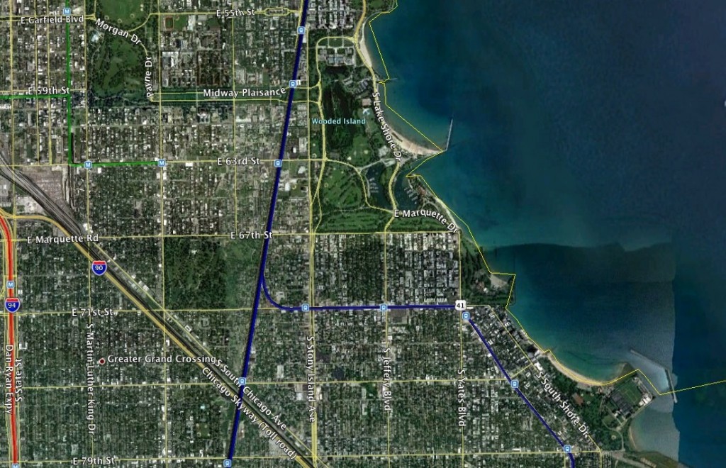
Rapid Transit: The CTA is proposing to extend the Green Line East 63rd/Cottage Grove Branch to Dorchester Avenue, which signals another U-turn by the transit agency. This portion of the Green Line was demolished during the renovation between 1994-1996 [1] due to community concerns about blight. The kicker is that the decision to abandon this portion of the line meant that the CTA was forced to forfeit federal funds. Now that they want to restore this portion its a safe bet that the USDOT will not be enthusiastic about federal funding for it. They did provide $384 million for the Cermak Branch of the Blue Line (now the Pink Line) but I maintain that that was done more for political reasons than operational necessity. Jackson Park is a major civic space on the South Side, and its presence is certainly justification for L service. It is quite confusing to hear people cite blight as a reason for demolishing a transit line, as a thorough renovation could have reversed that blight. Just because something is old doesn’t mean you tear it down; if people had followed that philosophy the CTA L would be a puny reminder of better days.

The overall issue is one of necessity: does Woodlawn have enough demand to justify reinstating Green Line service. An elevated transit line would be a large infrastructure improvement that could be replaced with enhanced bus service. Some have posited [2] that the opening of the Dan Ryan Line reduced the utility of the Jackson Park branch, leading to its demolition. This does bring up an important issue: the competition between the Green Line South Side Elevated and the Red Line Dan Ryan Branch. The main advantage that the Dan Ryan Branch has is its reach farther south compared to the Green Line, which means more riders. Having two lines competing for the same passengers is counterproductive; any bus going east stops at the Red Line first which undoubtably siphons off a lot of potential Green Line riders. The Green Line also competes against the South Lakeshore express buses that serve Hyde Park and other neighborhoods. The Metra Electric also serves the lakefront, and does a better job since it runs within a few blocks of the lake making it a lot more convenient; people taking the lakefront buses or Metra Electric do not have to transfer to another route to reach their lakefront destinations in Hyde Park, Woodlawn, or South Shore.
South Shore Trains

South Shore Trains

Bus Rapid Transit: The CTA is proposing a Bus Rapid Transit Corridor on Cottage Grove Avenue as well as 79th Street and Garfield Boulevard. Cottage Grove Avenue is well suited for bus rapid transit due to its generous width of four traffic lanes plus street parking. Unfortunately the analysis of X3-King Drive ridership seems to indicate that there is a lack of interest in express bus service in this corridor. Part of the problem is the presence of lakeshore express buses running from Hyde Park to the Loop. If one is heading all the way downtown from Kenwood, Woodlawn, Hyde Park, or South Shore the lakeshore express buses are a far more logical method of travel since they run express for 47th Street all the way to Roosevelt. Cottage Grove Avenue was served by the X4 Express bus in the past, and its ridership situation strongly mirrored the King Drive buses. The average monthly ridership over one month (AMRM) was about 2,892 from 2007 to the end of service in 2010 while the ridership on the regular 4-Cottage Grove bus was 22,162 over the same period which corresponds almost perfectly to King Drive when it had two buses: express AMRM was 13% of the regular route’s. If the CTA is insistent on bus rapid transit in this corridor, it would be wise to combine the King Drive and Cottage Grove BRT proposals. One possible way of doing this would be to implement a scheme similar to the Michigan Avenue-Indiana scheme where one road handles northbound and the other southbound. The Southbound BRT could run on King Drive and the Northbound BRT could run on Cottage Grove. This would reduce the impact of buses on traffic since only one lane would be used on each road instead of two. The CTA would be wise to explore similar implementations in other heavily used corridors since many Chicago thoroughfares are somewhat narrow (Ashland, Halsted and Broadway come to mind).

Another CTA proposal involves installation of equipment to give the 79th Street bus priority at traffic signals. This is very similar to my aforementioned proposal for BRT on this street. One difficulty that faces Chicago when it comes to implementing an idea like signal pre-emption is the technological lag in many areas. Numerous Chicago traffic signals still use electro-mechanical timers instead of solid state computers with road sensors. Upgrading the traffic signal technology on the major road corridors would be a positive but expensive step; a much cheaper way to speed up buses would be to relocate all bus stops to the side of the intersection past the signal so that buses do not get stuck at signals while discharging passengers. Another step would be to eliminate the acceptance of cash on buses and use farecards exclusively. Farecard machines would be installed at major points of commerce along 79th Street to facilitate this.

Integrating Metra:
Electric Tracks

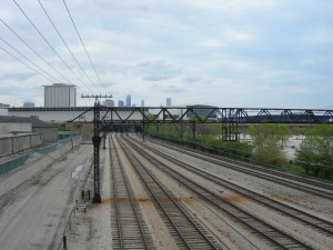
Another plan involves running Metra trains more frequently in the lakefront Electric corridor and building a new station at 35th Street. There are multiple problems with the viability of such a proposal, mainly the fact that there are already better options for transporting people along the lakefront. The south lakefront express buses make very good time, with speeds approaching 30 miles per hour which rivals the Metra Electric. More importantly, Metra is very labor intensive since trains require an engineer and at least one conductor to collect fares from passengers.

Transforming Metra into a rapid transportation system from a commuter rail system would require a dramatic change in operations. One problem with implementing frequent service (10 to 15 minutes between trains) is the amount of rolling stock that would be required. The specific number of cars would depend on the current passenger demand pattern throughout the day. It could be possible to provide more frequent service with the current fleet by running shorter trains; shorter trains would allow more runs per hour but run the risk of stranding people on the platform for long periods of time due to crowding. There is another problem with shorter trains: longer trains would either have to be assembled when they are needed or kept in a ready state. Permanently assigning some trains to low frequency duty would reduce the number of short trains available for rush hour. This type of situation would be preferred by yard operators since it would cut down on the amount of coupling and switching that has to be done and keep more trains in revenue service.

It would probably be better to simply detach the Metra Electric corridor from the body of Metra and have the CTA assume responsibility for operations. Metra simply doesn’t have the experience of providing service at such high frequency. Implementing a fare card and turnstile system would be very difficult since Metra platforms aren’t really set up for it; a lot of the head houses are quite cramped and would only allow a few turnstiles. Turnstiles did exist in the Metra Electric corridor in the past, but the functioned more as access barriers rather than fare collection devices (tickets were still checked on the train). The CTA would also have to bring back conductors whom they eliminated when switching to one person train operation.

Whatever decisions the CTA makes regarding south lakefront transit, it needs to make sure it doesn’t reverse course after a year and undergo costly dismantling of its latest blunder.

Detroit Downtown

Service Cuts: Path to Ruin

From NPR

<<Bus Service Cuts in Detroit>>

America is a country that is heavily dependent on car ownership, with 86 percent of commuters using a car to get to work in 2009 [1].  76% of commuters drove alone during their commute—that equals over 105 million people.  Public transit ridership is therefore a relatively small component of the transportation system in this country but the people who tend to use it are very dependent on it.  Cutting public transportation is a very incendiary issue as a result, due to the racial makeup of public transit riders.  Blacks have the largest percentage of commuters (11.5%) using public transportation than any other ethnic group; cuts are likely to affect them dispraportiaonately especially in Detroit.

The racial makeup of Detroit is almost 83% Black [2] with high levels of poverty and functional illiteracy [3]; obtaining the opportunity to operate a car not only involves financial obstacles for a large portion of the public but learning difficulties as well for some drivers when it comes to driver education.  If workers in these situations are going to find and maintain employment then public transportation must be adequately funded.  Public transit riders already face some of the longest commutes in the country; despite the frequent stories concerning gridlock on expressways the average commute time nationwide in 2009 was only 25 minutes.  The New York City metropolitan area has the longest average commute time of 34.6 minutes; coincidentally, it also has the highest rate of public transportation usage, about 19%.  Over 50% of commuters in New York City proper get to work using public transportation.

Cutting public transportation funding means two things: fewer routes and less frequent service.  Fewer buses per hour means that public transit riders in Detroit can expect to wait even longer for buses which will likely force many to leave earlier to reach their job, thereby taking them away from the home for longer periods.  This has negative implications when it comes to issues like childcare.  Longer commutes and more time away from home will likely lead to decreased morale among commuters and increased domestic problems as well.  Another problem is that commuters who miss buses will face longer wait times in very adverse conditions; Detroit’s location in the Upper Midwest means plenty of cold and snow in the winter.

Fewer routes means some riders will have to travel farther to reach a bus stop.  This would place additional hardship on the elderly who due to fixed incomes or physical inability to drive rely heavily on para-transit and buses.  One solution would be to abandon traditional routes using major thoroughfares and instead adopt ones that go into neighborhoods and pick up passengers.  People would ride the bus longer but have a shorter walk to the bus stop.  Such an approach would require a detailed analysis of where transit riders live and detailed bus stop usage statistics.  Detailed bus stop usage analysis could also be used to eliminate stops that are significantly underutilized thereby allowing the bus to travel faster.  Faster commute times could allow people to reach work in time even if they miss their preferred early bus.

There has been much talk by politicians during this election cycle about people who don’t want to work or are lazy.  The fact of the matter is that many people in cities like Detroit face tremendous hardship in reaching their places of employment; some workers have probably lost jobs because of attendance problems caused by long commutes dependent on multiple transfers.  One worker in Detroit spoke about losing an hour of work because of cutbacks in schedules [4]; people in these situations are at a disadvantage in the workforce compared to commuters without such restrictions.  If governments want to promote economic growth then action must be taken to help people in these situations.  If a worker has to catch a particular bus in order to pick up their children, then after school and daycare programs need to be expanded so that people do not have to leave work earlier than they would like.  Unfortunately since public transportation is being cut in Detroit other public programs are likely facing similar cuts.

Cutbacks in urban transportation systems like Detroit’s are not the right method to ensure fiscal health.  People are going to have a harder time getting to work, and some might even lose their jobs because of these cutbacks.  Businesses having to close down due to decreased patronage is another possibility.  If governments are serious about getting people back to work then public transportation funding needs to be increased instead of cut, and the transportation costs for all Americans need to go down.  The best way to do that is for people to abandon driving to work alone and carpool, or better yet, take public transit.  We can only hope such a change happens sooner rather than later.

[poll id=”2″]